NAN
Nan,
a miracle city embraces varieties of
interesting spots and
considerable charm. There are depths of
the Thai history behind, from pre-historic ancient time until now
that waited for
you to explore.
The city occupies a
huge area of
11,472.076 S.kms. or approximately 7.17 millions rai. Geographically, Nan
is a border city which 80% of the
area is nestled between mountain ranges paralleled along the
east and the
west side lying from north to south. There is
277 kms. Luang Prabang mountain range, a
natural border of
Nan and Luang Prabang cities stretching as
a borderline from north to
east. Phi Pannam mountain range lies along the
west separating apart Prae and
Nan provinces, which is
the up stream of
Yom and Nan
rivers, comprising important mountain tops such as
Doi Wao, Doi
Phachang, Doi Phachi���
Nan has
been an important city in
the upper north regions since the
former time as
appeared the archaeological evidence being a
residential area for
people in pre-historic period. His
toric sites and
antiques found in
Nan shows that the
province involved in stories of
influential kingdoms such as
Sukhothai, Lanna, Lanchang, in
which are so
valuable in arts and
architects and cannot easily be
found in other places.
Nan is
not just a
hidden city behind the
hill as in
the past. Roads are
smooth and in
good condition. The
mountainous land and
long-established
history together with the
simple living in
old-day atmosphere make the
city a �lively old
town�. It is
also recognized to
be the land of
natural miracles as
there are up
to 7 national parks generating a
high tourism potential. Whoever has
a chance to
visit the city, cannot refuse that Nan
is an impressive and
indelible place to
visit. Its beauty was
briefly described as
a saying �The land of
sloping mountainous beauty, lively old
town�

Historical Chronology
� By the
end of B.E
18, Nan became an
independent and moderate-size state which had
its evolution closed to
Sukhothai dominion. The
background started from a
tribe leaded by
Praya Phuka, annex the
flat land on
the upper part of
Nan in which the
center was located at
Yang city. Chao Khun Fong, the
protégé of Praya Phuka brought some troops to
settle another city called Pua
on the flat land in
Tambon Silapetch, Amper Pua
(nowadays) which thereafter was
taken over by
Praya Ngam Mueang from Phayao for
a period of
time. Pua had
started to establish a
good relationship with Sukhothai by
then in an
effort to balance the
political power with Phayao. The
time had passed until the
year 1902 B.E., the
growing city leaded by
Praya Karn Mueang, th
descent of Chao Khun Fong was
moved down to
south by the
east bank of
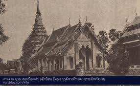
Nan River. The
City had been built to
encircle Pratat Chaehaeng Chedi, then the
holy relic from Sukhothai was
installed within the
Chedi. In the
year 1911 B.E. when Chae Haeng city has
faced a famine; Praya Phakong the
son of Praya Karn Mueang then decided to
move the city again to
the west bank of
nan River which is
the location of
Nan city until now.
� Nan established good relationships in
commerce with small surrounding cities such as
Luang Prabang, Lanchang, Sipsong Panna that subsequently created strong relationship in
politics and caravan trading along Maekong river. Before Nan
was merged to be
a part of
Lanna, the relationships of
the two cities were commercial-trading involved. When Chiangmai was
a colony of
Burma under the
king Hongsawadee during the
year 2096 � 2101 B.E.; Chao Praya Plolathep Ruechai, the
governor of Nan
has escaped into Luang Prabang. Yet
Nan was still under the
governance of Burma until the
end of Krungsri Ayudhaya era
in the year 2310 B.E. Nonetheless, the
hard time of
Nan was during 2101 � 2317 B.E. that it
had been fighting for
the freedom many times, people were suffered and
escaped into the
jungle, some were taken to
be slaves, city and
temples were burnt down.
� In ter
year 2331 B.E. Chao Uttaworapanyo, the
vassal prince of
Nan had surrendered to
Bangkok (in the
reign of king 1 st) and
started a policy �brig vegetable into the
basket, bring people into town�, a
lot of Tai
Lue people were immigrated back to
Nan In the
reign of king 5th, the
encroachment of the
colonialism of Britain and
France, Bangkok reformed the
governance of Lanna into centralization in
2435 B.E. that central government of
Bangkok appointed commissioners to
manage the city affair instead of
aristocracy group.
� After the
193 crisis that Siam had
lost the west bank area of
Maekong river to
France, Nan gained its
importance as a
frontier to Luang Prabang, a
colony of France. The
relationship between Nan
and Bangkok had
been doing well so
the 5th King promoted Chao Suriyapong Paritdetch to
be Prachao Suriyapong Paritdetch to
reward the goodness of
Nan in helping Bangkok to
figth tn the
rebellious war in
Chiangtung.
� Nan became to
the province of Thai in
the reign of
King 7th. After Chao Mahaphrom Surathada, the
last governer of
Nan was died in the
year 2474 B.E. thus, the
rule of prince was
abolish from the
moment.
Nan is
a northern border of
Thailand, about 668
kilometers from Bangkok, covering an
area of 11,472 square kilometers or
approximately 7 millions rai. It
is embraced by
mountains and recognized as
a land of
east Lanna in
Sukhothai. The assumption is
that approximately during the
12th century B.E., Praya Phuka built a
city on the plain land in
the upper part of
Tambon Silapetch or so
nowadays called Amper Bua. The
former name of
Nan is Nundhaburi or
Woranakorn. Until the
time of Praya Karn Muaeng, he
had received 7
Buddhas relics from Sukhothai and
brought the relics to
be kept in
Doi Phu Piang Chae Haeng. In
the year 1911 B.E. the
tide of Nan
River Changed its
direction causing draught, so
the city had
to be moved to
Ban Huay Tai
in the west bank of
Nan River.

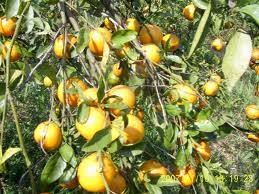
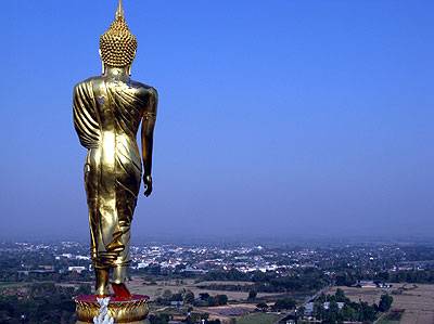
The slogan of
Nan
The Renowned Boat Racing, City of
Black Elephant Tusk, Wat Phumin�s Mural Paintings, Land of
Golden Orange, and
Shining Pra Tat
Chae Haeng
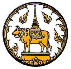
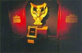
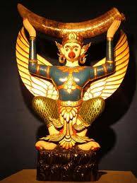
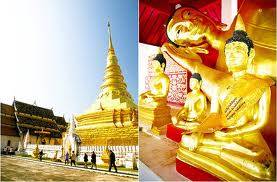
The provincial seal
shows Asuparatch bull carrying the
pagoda of Phra That Chae Haeng.
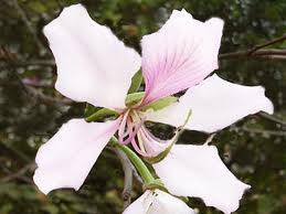
The provincial flower
is the Orchid Tree, Purple Bauhinia.
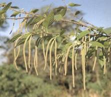
The provincial tree
is the Birch.
Territory Nan�s northern and
eastern shares a
277 kms. Border with Laos. The
west lies next to
Phare, and Phayao province. The
southern border connect to
Uttaradit province.
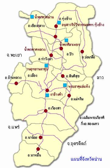
The administration Nan
comprises of 15
districts as follows : Mueang, Tha
wang Pha, pua, Chiang Klang, Wiang Sa,
Na Noi, Na
Muen, Mae Charim, Santi suk, Thung Chang, Chaloem Phra Kiat, Bo
Kluea, Ban Luang, Song Kwae, and
Phu Phiang districts.
Topography Nan
is embraced by
the granite mountain ranges � Luang Prabang and
Phi Pannam -
with the height of
600- 1,200 meters above the
esa level, stretching along the
province which account for
approximately 40% of the
area. Most of
the topography is
over 30-degree rolling, accounts for
about 85% of the
province, while
undulate areas which are
narrow basins in the
canyon along the
watershed of Nan, Sa,
Wa, Pua accounts for
7,170,745 rai, or
11,472.07 S.kms.
The climate of
Nan have 3
season, which are
summer starting in
March to May, rainy starting in
mid of May
to October, winter starting in
November to February
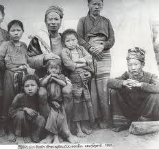
Population & People
We might be
familiar with the tribe of
Tai Lue and
their culture that can
be easily found in
Nan and most of
the upper north provinces, however, ancestors of
Nan were actually from Tai
Yuan. The population of
Nan is approximately 514,688 comprising the
various tribes as
follows.
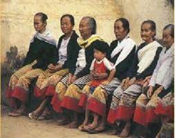
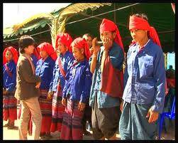
Tai Yuan
is the found the
most in Nan, living and
doing agriculture in
basin areas along Nan
River. Some scholare presume they are
Nan�s ancestors that had
moved from Lanchang living in
the left side of
Maekong River.
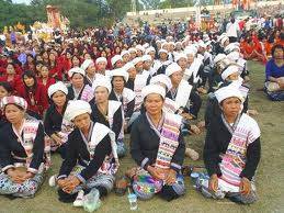
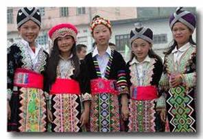
Tai
Lue was
based in the
border line between Sipsong Panna, Chiantung, Lao, and
Lanna. They had
immigrated into Siam many times for
several reasons i.e. privation, oppression from
Chinese and Burmese, refugee from China revolution, commerce, etc. Tai
Lue and Tai
Yuan share similar cultures in
terms of language, religious, costume, food, handicrafts, and
especially the �Ed-Na-Mueang-Loom� production or
paddy-seed-ling
farming. The cultural uniqueness of
Tai Lue is
Lai-Nam-Lhai pattern weaving textile, and
Lue pattern. The
weaving technique is
so called �Kao� (scratch) or
�Luang� (pick).
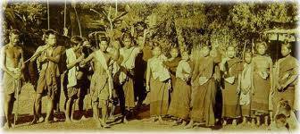
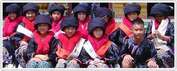
Lua
/ Htin is
the original tribe in
Nan including some who
moved from Chaiburi district in
Laos Htin is
an official name for
original community in
Nan. Lua people generally locate their residence up at
2,500 � 3,000 above sea
level. Along the
sub-river of Nan
such as Namwang, Namwa, and
Nammang, people earn their living by
growing upland rice, selling forest products, and
basketry making, for
instance. However, in
many villages people still believe in
nature-related ghosts such as
forest ghost, water ghost, field ghost, and
ancestor ghost. The
biggest tradition of
the year is �Sa-lode� or
�Kin Dok Dang� which celebrates the
offspring, and welcomes the
new producing year. Currently, most Lua
people settle down in
Ampur Chaloem Prakiat, Ampur Bor-Kluea, Pua, Tungchang, and
Chiangklang.
Kamu was
presumed to be
located in borders of
Nan and Laos for
over 200 years ago, and
that in the
year 2343 B.E. they were forced to
be workmanship for
Nan city wall. James F. McCarthy who made a
mapping survey in
the north region during 2433 � 2436 B.E., mentioned that there were 2
groups of Kamu � Kah Lao
(under Laos �
governance), Kah Kwan (under Nan�s governance.), Kamu people have a
reputation of being skill-blacksmith, making good quality of
metal equipments such as
knife, sword, spud, hoe, etc.
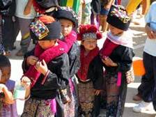
Hmong
(Maew) descended from Tibet highland, Siberia, and
Mongolia to china, Laos, and
Thailand. It is
believed that Hmong had
immigrated to Nan during 2433 � 2442 B.E. They are
skilful in commerce, cattle, growing industrial crop such as
lychee, longan, as
well as silverware making. They believe that silver represents richness and
auspice.
Mian (Yao)
descended from Yunnan, Hunnham, Guangxi, Guang Zhou, and
other cities from east China. Their residences are
located over 1,000 meters above sea
level. Therefore,
Mian�s cultures are
influenced from Chinese such as
language, husband�s lastname adoption, using of
Sae (Chinese family name), Chinese new year. Most Mian people are
living in Ampur Mueang, skillful in
embroidery.
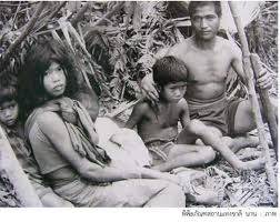
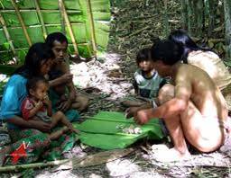
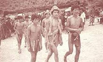
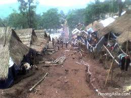
Mlabri (Tong Lueang) was
presumed to be
an immigrant of
Lawa tribe that had
escaped Tai invasion into the
jungle in Chaiyaburi district, Laos for
over 100 years ago. They originally lived by
wildlife hunting and
collecting forest product the
Mlabri customarily move on
When the Leaves of
Their temporary nuts turned yellow. Mlabri people locate themselves in
Viangsa district.
